Warmer temperatures and the weekend rain are still keeping residents of northern Maine and other parts of the state on high alert for spring flooding.
Fort Kent officials are asking residents there to curb their use of water over the next few days as the town’s treatment plant is being challenged by the runoff, melting snow and rising St. John River.
“The Fort Kent Wastewater Department is asking all residents who are currently using sump pumps attached to the town sewer system to discontinue use immediately,” town manager Suzie Paradis said in a Facebook post over the weekend. “This is not a permissible use, sump pumps are not allowed to go into the town sewer.”

Broken ice flows down the Aroostook River in Presque Isle Easter Sunday evening near the confluence of the Presque Isle Stream at North Main Street.
(Staff photo/Paula Brewer)
With the treatment facility still having difficulty keeping up with heavy water flow on Monday, Paradis issued another request to have residents minimize their water usage by reducing the length of showers, and postponing household chores such as dishwashing and laundry. Residents also were asked to avoid any outdoor watering, such as washing vehicles.
“Think hard about how you are using water over the next few days,” Paradis said.
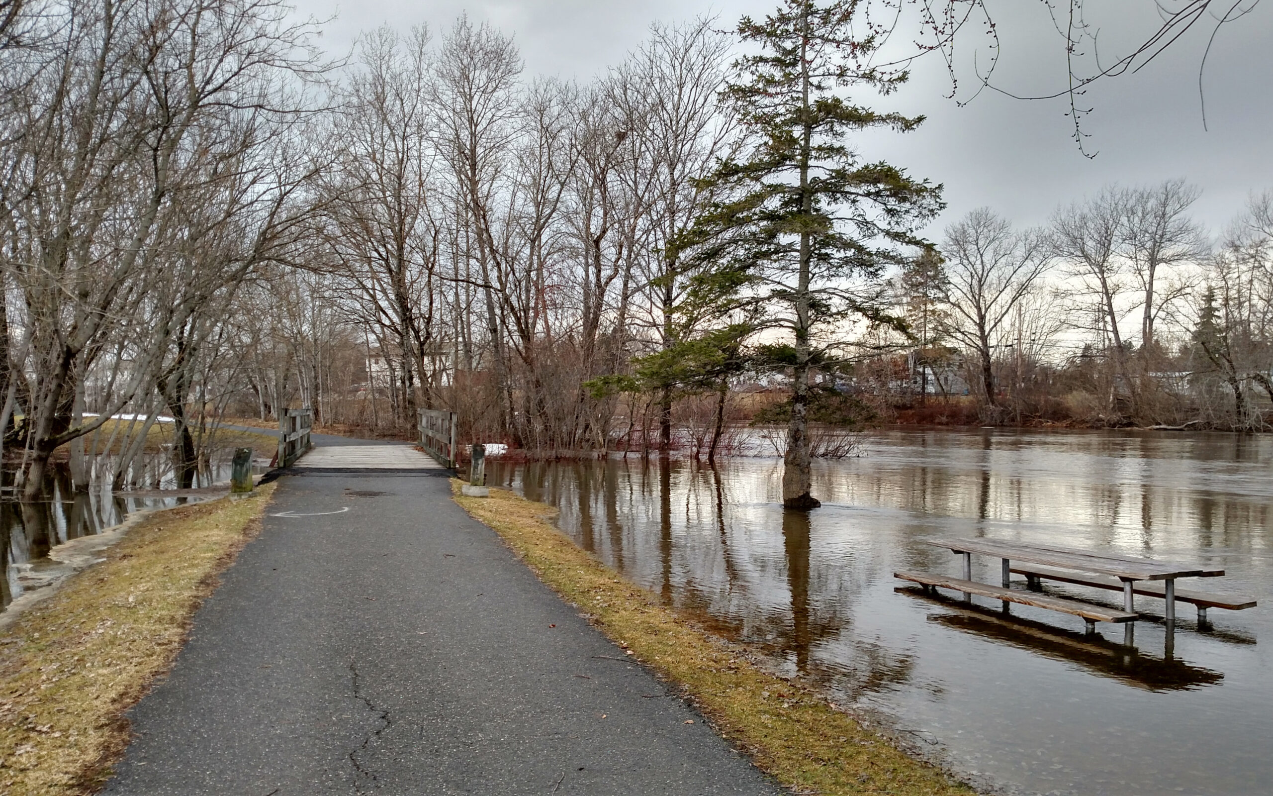
As of Monday morning, the St. John River in Fort Kent was at 22 feet, nearing flood stage which is 22.5 feet. River water had crept up over Riverside Park and the area surrounding the Lion’s Pavilion, prompting officials to block off a portion of River Street.
“The St. John River river is expected to crest, probably slightly above flood stage in the next 24 hours,” said Chris Norcross, a meteorologist with the National Weather Service in Caribou. “It could crest and start to drop back down.”
While a flood warning was cancelled for the Fish River, which flows into the St. John at Fort Kent, but it remained in effect for the Big Black River farther west in the North Woods; the Mattawamkeag River above Mattawamkeag in Penobscot County, the Androscoggin River near Auburn, and the Kennebec River at both Skowhegan and Augusta. Minor flooding is occurring and expected to continue in those areas.
“Although the heavy rainfall has ended, rapid snowmelt in areas that still have snowpack will persist, bringing many streams out of their banks Monday,” according to the National Weather Service. “The larger rivers will continue to see rises into Monday with minor to moderate flooding expected.”

Broken ice flows down the Aroostook River in Presque Isle Easter Sunday evening near the confluence of the Presque Isle Stream at North Main Street.
(Staff photo/Paula Brewer)
Without more rain, the rivers may begin to subside by Tuesday or Wednesday.
Norcross said Aroostook County may experience several bouts of intermittent mild precipitation beginning Tuesday and perhaps a few other days this week, but at this point the forecast does not call for any heavy rain in the area.
Fort Kent Police Chief Tom Pelletier, whose department keeps hourly tabs on the St. John River level, said officials are hoping to avoid any serious flooding.
“We’re hoping that we’re close to the river’s peak. It may rise a little bit more but we’re constantly monitoring the situation,” he said.
Other rivers in Aroostook County do not seem to be at any imminent risk of flooding, although officials are still monitoring those waterways as well.
On Monday morning the Fish River at Fort Kent was at 10.2 feet. Minor flooding begins to occur at 11 feet. At 12 feet the Fish River threatens the Soldier Pond and Wallagrass area.
In Washburn, the Aroostook River was at 12.5 feet; flood stage is 14 feet. In Mattawamkeag, the Mattawamkeag River was at 15.3 feet, down slightly since Sunday when it measured in at 15.56 feet. Flood stage for that river is 17 feet.
“I think we’re in much better shape then we were predicting last week, so things are heading in the right direction but we are not completely clear of flooding issues yet,” said Darren Woods, director of Aroostook County Emergency Management.

The sign for the boat launch on the Aroostook River in Ashland sticks out of the high-running river on April 22.
(Contributed)