
CARIBOU, Maine — An active winter has already brought significant snowfall to some parts of the state, with officials at the National Weather Service in Caribou expecting more to blanket the state Friday.
Rich Norton, meteorologist at the Caribou station, said Friday morning that a winter storm warning is in effect for parts of Aroostook, central and southern Piscataquis and Penobscot counties. Far northern Maine and a portion of the coastline around Washington County is under a winter weather advisory.
Heavy snow is expected throughout the day, with the middle part of the state expected to be hit hardest. He said that the storm would essentially cut through the middle of the state.
“It looks like the most snow is going to be from Houlton down to western Maine,” he said. “A majority of Penobscot, Piscataquis and Kennebec counties also will be impacted.”

Quentin Sonderman of Houlton walks along a snow covered sidewalk on Broadway in Houlton Friday afternoon. The second storm in three days dropped several inches of new snow on the Shiretown. (Joseph Cyr)
He said that those regions should expect up to eight inches of snow, while a foot of snow was expected to fall on Mount Katahdin. Bangor should receive six inches by nightfall, with similar amounts predicted in portions of Hancock and central Washington counties.
“The coast should expect lesser amounts,” Norton said. “An estimated one to three inches is predicted there.”
Temperatures remained cool across Maine Friday morning, with the immediate coastline and the outer islands the only places that above freezing as of 9 a.m., according to forecasters.
The storm is being caused by a low pressure system moving up the East Coast.
“Things should start winding down by this afternoon,” Norton said. “After 8 p.m., however, another tenth of an inch is expected to fall in Bangor, with another inch predicted in Millinocket and Houlton. Caribou could see an additional two inches.
-

- A few blades of grass stand defiant as snow falls in Woodland on Nov. 16. (Chris Bouchard)
-

- Snowflakes gather on a car windshield in Woodland on Friday, Nov. 16. (Chris Bouchard)
-
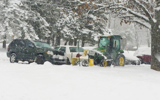
- A tractor clears a path at Houlton Middle-High School Friday morning as the snow steadily falls. School was dismissed for students at 11:30 in southern Aroostook schools. (Joseph Cyr)
-
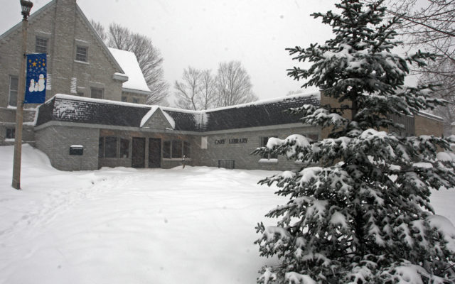
- The Cary Library in Houlton was quiet Friday as the Shiretown endured its second blast of arctic weather in three days. (Joseph Cyr)