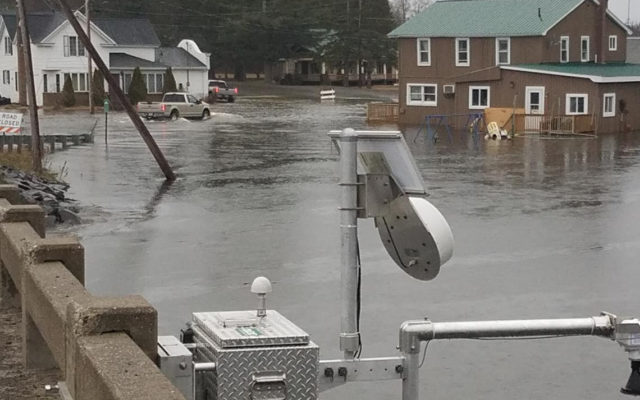
FORT KENT, Maine — Officials are on high alert as they monitor the Fish River for the potential of increased flooding in Fort Kent and surrounding areas, but if current weather forecasts hold, the waterway should not spill over the Fish River Bridge onto Main Street in town as it did during the flood of 2008.
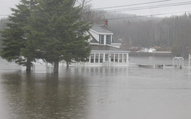
Many homes and camps along the Fish River chain of lakes remained inundated Thursday, including at Portage Lake, Saint Froid Lake, Eagle Lake, Square Lake, Cross Lake, and Long Lake. Some structures have flooding onto the main floor, not just the basement, according to the NWS.

This map from the U.S. Geological Survey shows the location of two permanent USGS stream gauges in Fort Kent and a temporary gauge installed on May 2 at Soldier Pond in the Fish River to monitor flooding. The temporary gauge is further upstream on the Fish River. Flooding in the area began in April due to rainfall and snowmelt. Additional rainfall, warmer temperatures and further snowmelt extended the flood duration into May.
(Courtesy of Nicholas Stasulis/USGS)
Additional rainfall of up to three quarters of an inch anticipated in the affected areas into Saturday morning “will lead to water level remaining fairly steady into the weekend,” the NWS reported Thursday.
The St. John River remains below flood levels having measured at 21.44 feet on Thursday at 9:45 a.m. It is expected to reach its highest point at 21.6 feet at 8 p.m., still below the 22.5 foot level where minor flooding occurs.
“If things keep going the way they are, we’ll be all set,” Fort Kent Public Works Director Tony Theriault said Thursday morning. “People are concerned that the water is going to cross the street and reach the (St. Louis) church, but we’re still a long ways from that.”
Theriault met with interim town manager and police Chief Tom Pelletier on Thursday morning to discuss the situation. Both have made plans should predicted rainfall amounts drastically increase, presenting the potential for a major flood.
“I still got ready. I called people and lined up places to get gravel so that’s on standby,” Theriault said. Crews used the gravel to create makeshift berms in 2008 that prevented flood waters from reaching more parts of town.
“Fortunately we didn’t get the anticipated amount of rain throughout the night which was originally forecast so that kept the rising river levels lower than anticipated,” Pelletier said Thursday morning.
“We’re comfortable with the [Aroostook County Emergency Management Agency] assessment at this time, but we’re still in the alert stage and will continue to be,” Pelletier said.
He added that the Red Cross would have emergency clean up supplies staged in the town sometime Thursday, should they be needed.
“We are prepared. Our highway department is prepared for mitigating any further rising waters. We have resources available and are prepared to move forward as we continue evaluating the situation on a regular basis,” Pelletier said.
The causeway on Long Lake to Pelletier Island in St. Agatha remained under six to eight inches of water and closed Thursday afternoon.
Some residents of the island chose to evacuate their homes while others hunkered down.
The town did not issue an evacuation order, according to town manager Aubrey Michaud.
“We haven’t evacuated the island; the people who wanted to leave could choose to leave but nobody’s homes are in danger of flooding. The road is the only thing that’s closed,” she said Thursday.
Marc Nadeau said that his family chose to stay on the island for now, as their house remains undamaged by the flooding.
“We parked our vehicle on the mainland and are prepared to either walk across or paddle across if needed,” he said.
Nadeau said that about half of the residents living in 22 permanent homes on Pelletier Island have evacuated.
On Wednesday, the United States Geological Survey installed a a temporary rapid deployment gauge along the FIsh River in Soldier Pond to monitor flooding in the area. The gauge will measure and transmit water data that also will be useful to forecast flooding downstream in Fort Kent, according to a press release from the USGS.
Laurie Lozier, owner of Lake Road Grocery in Wallagrass, said Thursday morning that business has been steady in spite of Soldier Pond Road being closed.
“We have some people who normally come in who aren’t coming in and some people buying gas and stuff for generators who normally probably wouldn’t,” she said.
Voisine and her family live on Church Street, but have not needed to evacuate their home so far.
“A lot of our neighbors are affected though,” she said.
One of those neighbors is Lake Road Grocery employee Felicia Lewis, who along with her husband Jason Lewis and their four children evacuated a home they rent on Soldier Pond Road just next to the bridge. The Lewis’ sent their children to stay with relatives while the two are temporarily staying in a small cabin across from the grocery store until they learn whether they will be able to return to their home.
“We just don’t know where we’re gonna go,” Felicia Lewis, 33, said. “It’s not like (rental) houses are popping up all over the place.”
Despite being uprooted from her home and having her family temporarily separated, Lewis is trying to remain positive about the situation.
“The thing is it’s hard or whatever. We lost some material items, but we’re safe and our kids are safe. We got them out before it got really bad,” she said. “Other people have it worse than we do. The houses above us all had water in them days ago so they’re gonna be at more of a loss than we are. Some of them might not have a home to go back to because they own their houses and we don’t.”
-
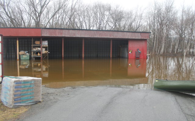
- The driveway leading to the S.W. Collins lumberyard in Fort Kent appears to be more of a boat ramp as waters from the Fish River flood the area Thursday. (Jessica Potila)
-
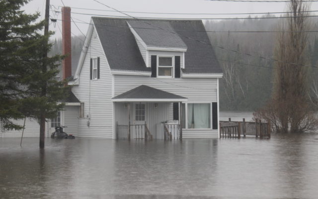
- All residents of Bouchard Street in the Soldier Pond area of Wallagrass evacuated their homes this week due to flooding from the nearby Fish River. This vacated home stands surrounded by water on Thursday, May 3. (Jessica Potila)
-
- All residents of Bouchard Street in the Soldier Pond area of Wallagrass evacuated their homes this week due to flooding from the nearby Fish River. This vacated home stands surrounded by water on Thursday, May 3. (Jessica Potila)
-
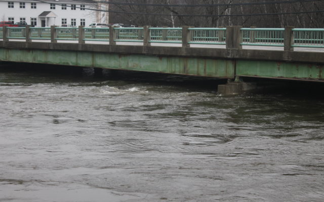
- Rising water flows just under the Fish River Bridge in Fort Kent on Thursday morning. (Jessica Potila)