Still in the throes of the last gasps of summer, parts of northern Maine experienced the first frost of the season Sunday and Monday mornings.
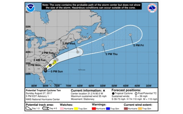
The cold temperatures came as weather forecasters monitored a potential tropical storm forming along the southern Atlantic coast, just days after the Category 4 Hurricane Harvey hit Texas. The new storm, which will be named Irma if it reaches tropical storm status, is expected to hit Massachusetts as early as Wednesday and cause heavy rains for as long as 12 to 24 hours before moving on, according to AccuWeather meteorologist Alex Sosnowski.
But for now, some Mainers are starting to feel the chill. The National Weather Service station in Caribou recorded patchy frost across Maine Monday morning, and 32-degree temperatures in places like Estcourt Station, Fort Kent and along the Allagash River.
Estcourt Station actually hit the 31-degree mark on a morning back in late July, Toddy Foisy, meteorologist in the Caribou office said Monday morning.
The band of cold temperatures stretched across almost the top half of the state. Places like Clayton Lake, Houlton, Caribou and Jackman showed temperatures in the mid to high 30s.
The County is pleased to feature content from our sister company, Bangor Daily News. To read the rest of “Maine sees late summer frost as potential tropical storm spins north,” an article by contributing Bangor Daily News staff writer Alex Acquisto, please follow this link to the BDN online.